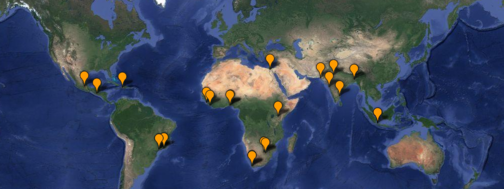
INFORMAL SETTLEMENT MAPPER
About: The United Nations Development Programme defines informal settlements as residential areas where housing units have been constructed on land to which the occupants have no legal claim. Therefore posing problems of sanitation, health, overcrowding, and violence to the residing population. Through Google satellite view and UNDP data, this project involves researching and geolocating these informal settlements or slums throughout the world. Bounds or extents of the settlements are visible through exploration of the satelite view in the application.
Skills: Fusion Tables, Fusion Layer Wizard, Google Maps, Bootstrap
Data: United Nations Development Programme 2010 and CIA World Factbook API