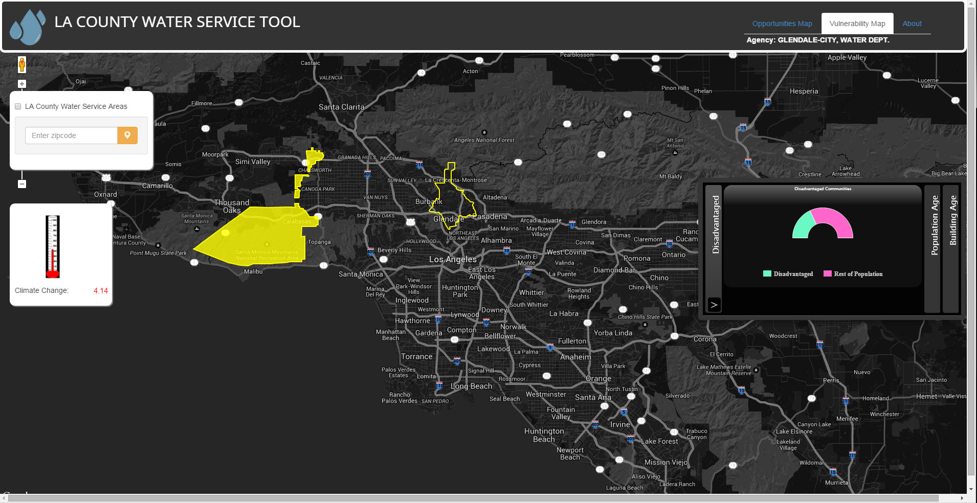
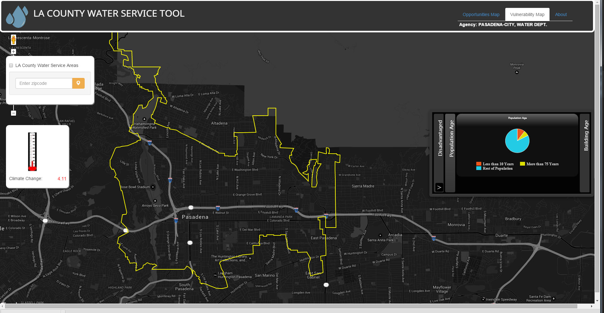
ROLE: GIS Analyst & Web developer
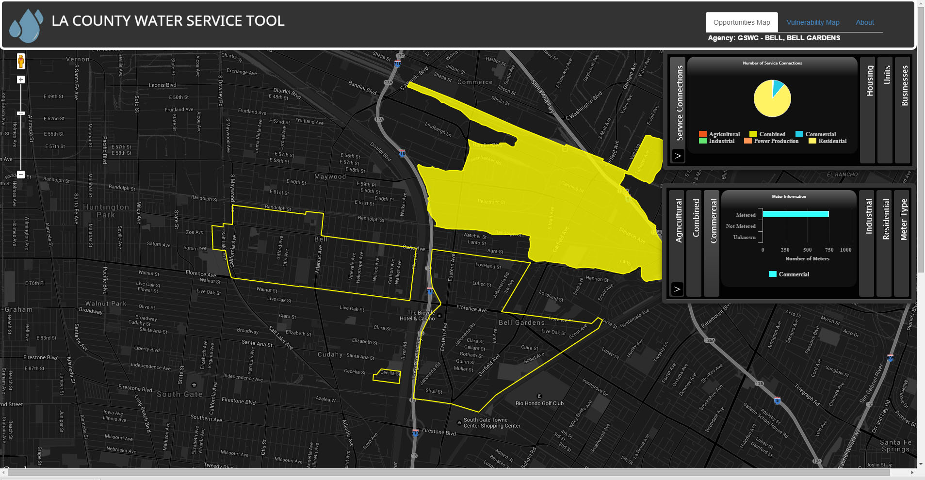
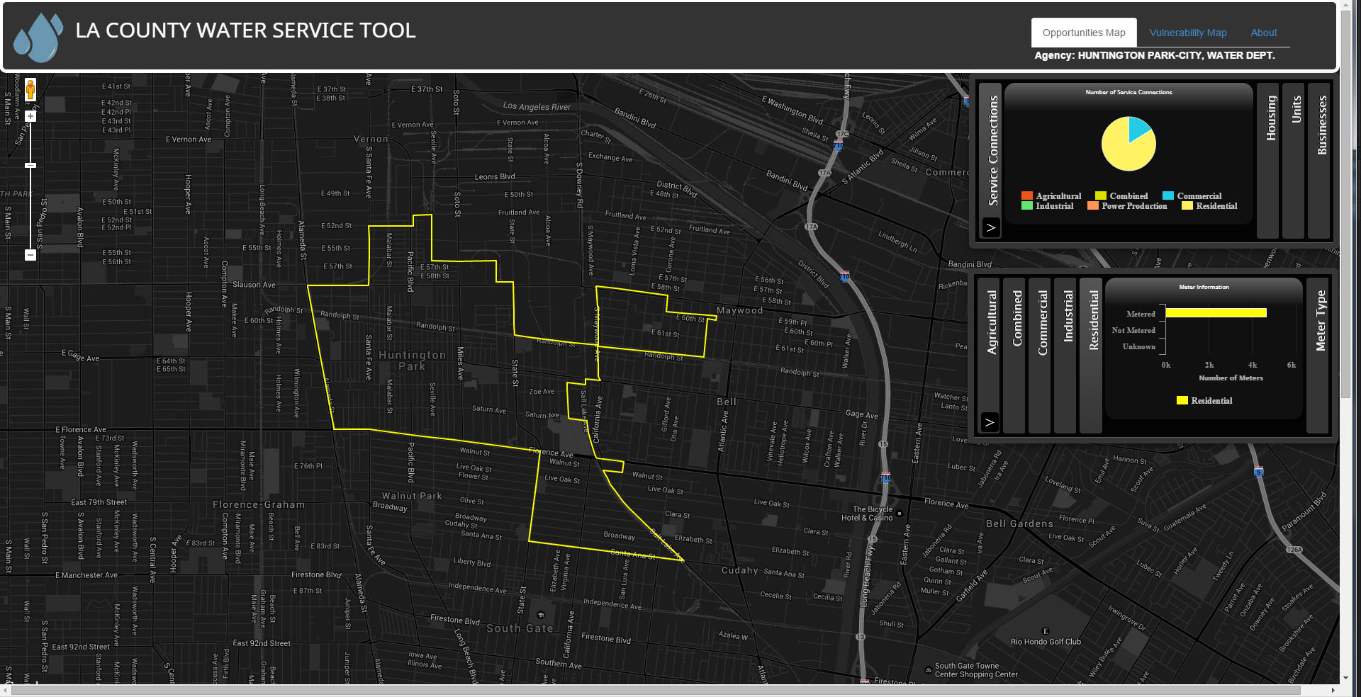
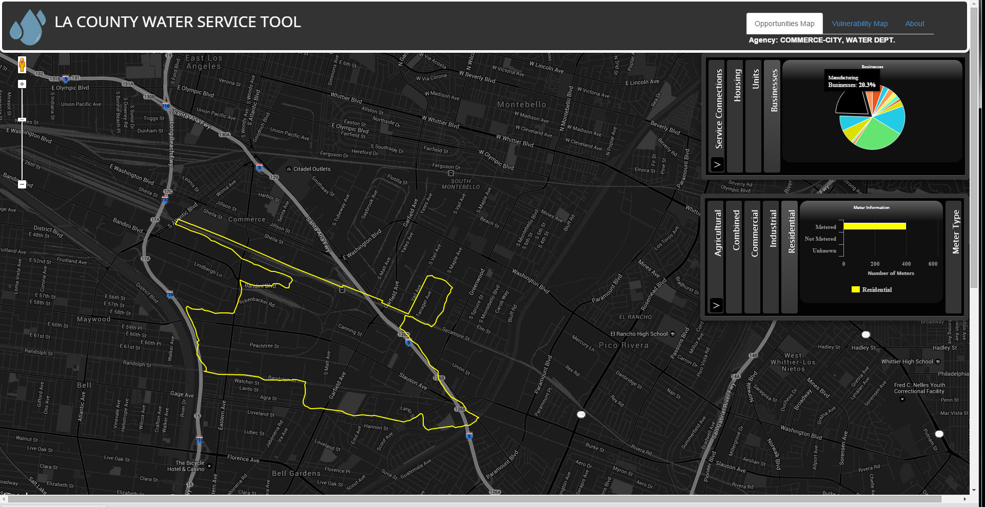
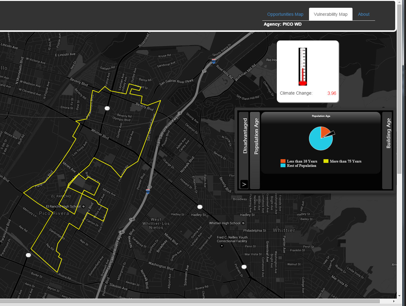
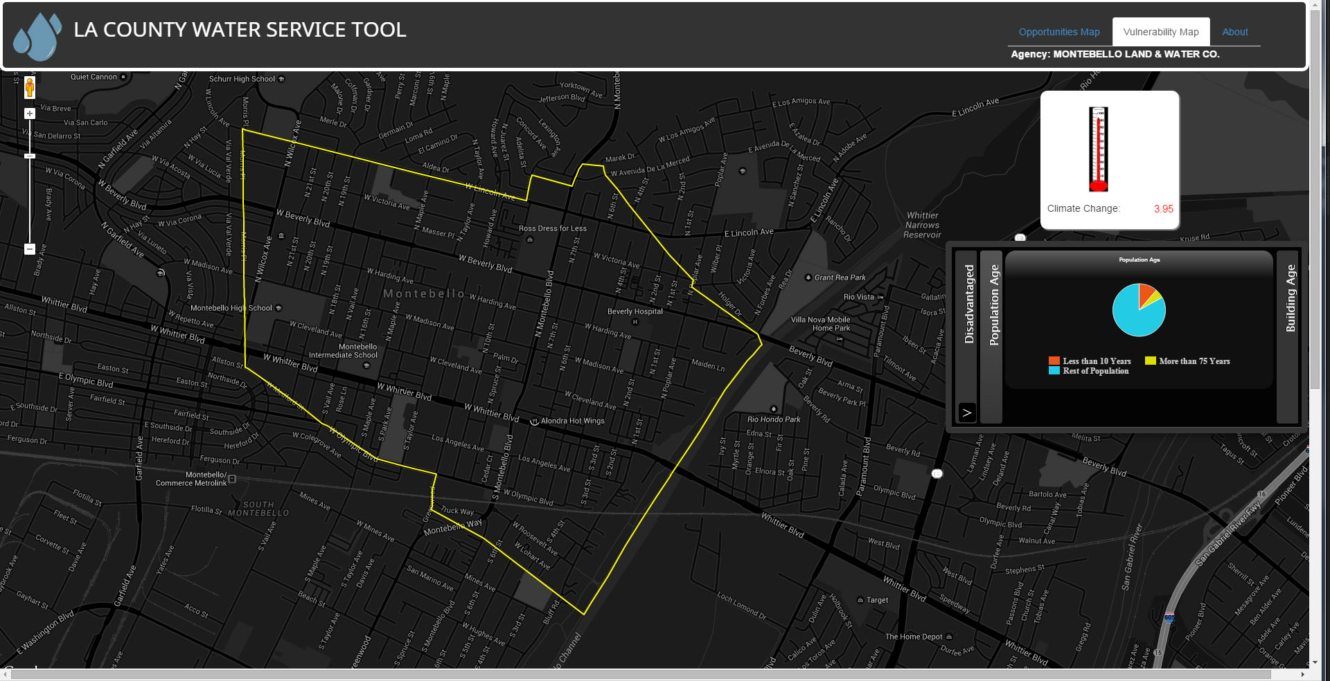
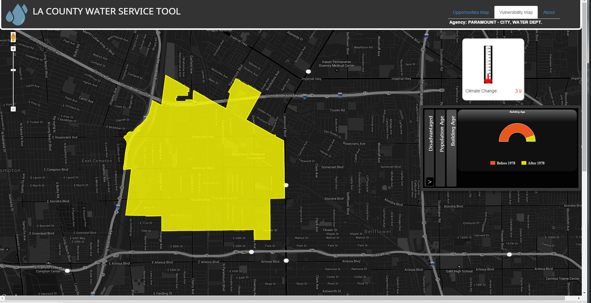
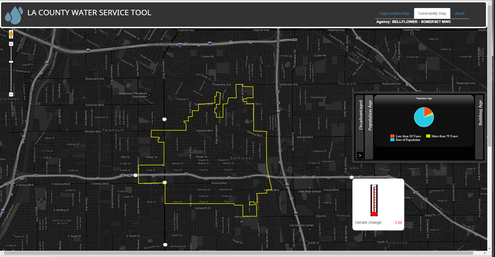
About: Few people know that Los Angeles County has 228 community water systems. These systems are responsible for providing drinking water to LA County residents. To get a better understanding of this landscape, I worked with the Luskin Center to determine the boundaries of these agencies. The geographical data was featured in the Luskin Center’s report, Community Water Systems. Further digitizing the process, I created a web map of these boundaries alongside important figures such as: population age, meter usage, service connections, low-income households, and temperature increase. Ultimately, this report and application aims to provide policy makers a more comprehensive and integrated look at potable water in Los Angeles.
Skills: ArcGIS MapService API, Google Maps API, HighCharts API
Data: Data from Luskin Center Research
Press: CITYLAB, Los Angeles Times, VICE News